2019-2023
Funding agency: Israel Science Foundation
Primary researcher: David Pearlmutter
Project supervisor: Or Aleksandrowicz
Project researchers: Michelle Clark Levenson, Morel Weisthal, Tanya Saroglou, Ayelet Eli-Av, Valeria Aynbinder
Research assistants: Wolfgang Motzafi-Haller, Yaakov Florentin, Tzur Blank, Yosef Mor
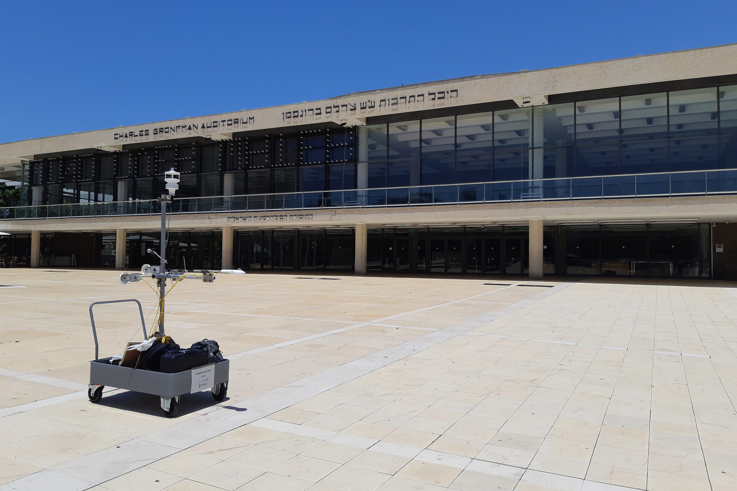
The research project set out to develop an integral microclimatic analysis tool that would support planning decisions related to urban heat mitigation and adaptation. We found the existing common computational tools for analysing the effects of urban heat on pedestrian thermal comfort to be too complex and resource-intensive to provide planners and designers with city-scale mapping of the variance in urban heat. Acknowledging that the main challenge lies in the complexity of calculating thermal comfort according to common comfort indices, the project was focused on addressing this gap by attempting to identify climatic variables that are relatively easy to calculate while providing a good indication of thermal comfort levels. For this, we conducted two monitoring campaigns of urban summer and autumn conditions in two Israeli cities (Tel Aviv-Yafo and Kfar Saba), and their results highlighted the critical effect solar exposure has on significantly increasing heat stress during daytime hours. Moreover, by monitoring pedestrians’ choice of walking routes in shaded and unshaded conditions, we were able to show that pedestrians tend to prefer walking in the shade during summer, thus further highlighting shade provision as the single most important climatic factor planning and design professionals should address.
The exceptional significance of shade provision in climatic planning enabled us to argue that mapping shade conditions across an entire city can be a valuable tool that could bridge the gap between the science of urban climatology and the planning and design professions in geographic locations where urban heat is a major climatic challenge. Essentially, shade is a direct outcome of planning and design decisions and mainly depends on the sheer physicality of urban features. Because of that, the calculation of outdoor shade is relatively less complex than the calculation of urban thermodynamics. Nevertheless, when calculating shade for an entire city, current tools are still relatively slow and cumbersome. The Urban Shade Assets Mapper, the tool we have developed in this project, is expected to streamline and facilitate the production of shade maps based on common and readily available geographic datasets.