2017-2021
Funding agency: Tel Aviv-Yafo Municipality
Research leaders: Or Aleksandrowicz, Shachar Zur, Yonatan Lebendiger, Yoav Lerman
The project attempted to apply state-of-the-art mapping technologies and calculation algorithms for high-resolution city-scale analysis of urban shade. This was done by developing several indices that can be used for comparing the microclimatic characteristics of streets and neighbourhoods across a city.
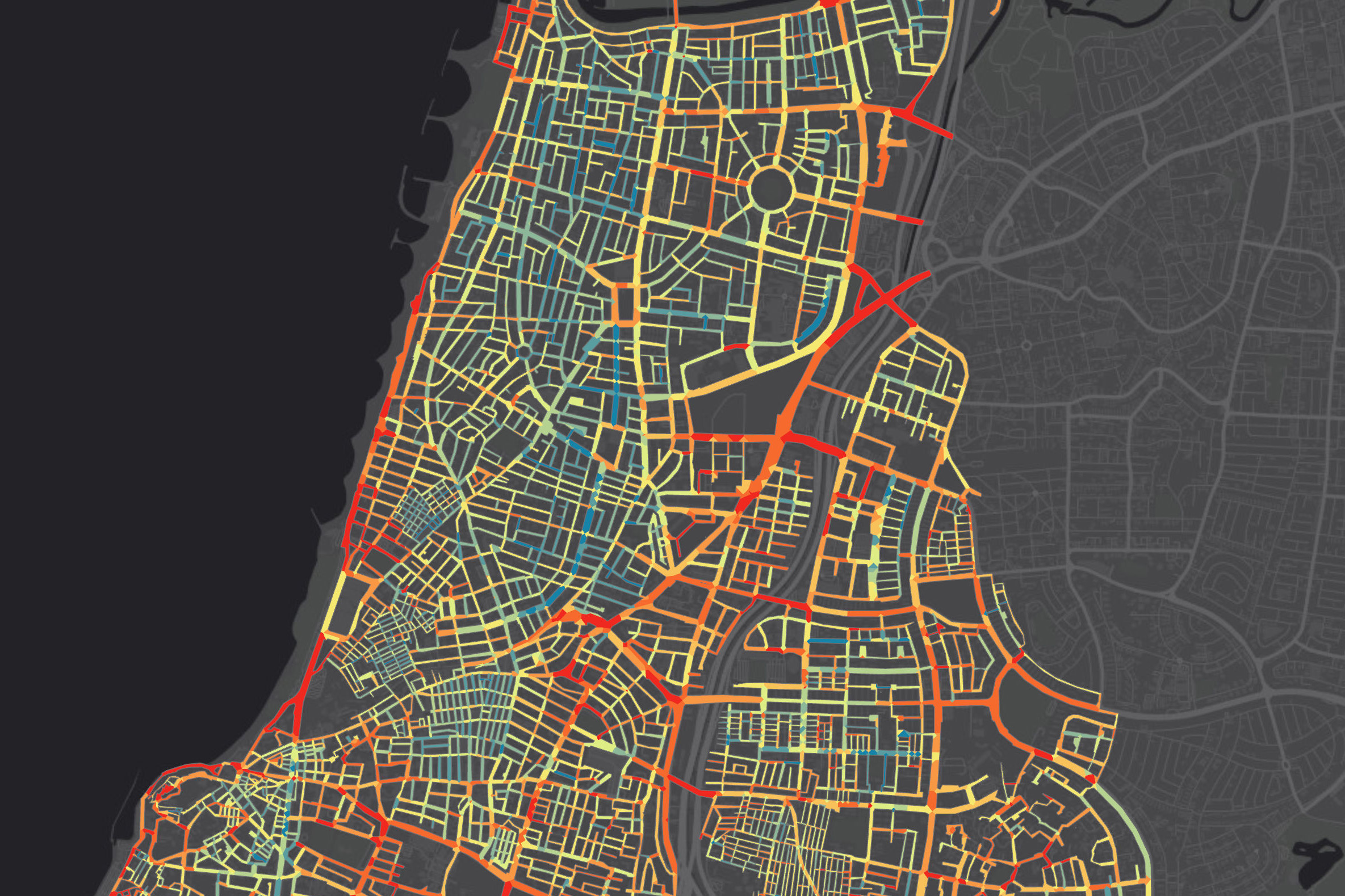
To calculate spatial shade indices, we first had to perform a calculation of solar insolation at street level using the Area Solar Radiation function in ArcMap, based on 2.5D mapping of all the buildings and trees in Tel Aviv-Yafo. Using the results of this calculation, we were able to calculate a Shade Index (SI) value for each pixel in the provided mapping, which describes, on a scale of 0 to 1, the ratio between the blocked insolation at a certain location and the maximal insolation of an unobstructed horizontal surface at the same time and location. The lower the exposure to direct solar radiation, the higher the SI value.
One of the city-scale maps we produced using the SI calculation procedure was a map showing average SI values for every street segment in the city during summer (specifically, in the month of August). The map highlighted the climatic advantages of north-south oriented streets over east-west oriented streets in terms of summer shade. This is a result of the local characteristics of the sun path: in east-west oriented streets, buildings’ effect on street shading is minor (since the summer southern sun appears high in the sky), and therefore reasonable SI values cannot be achieved without the application of a substantial and continuous layer of wide tree canopies.
Following the analysis of shade conditions at street and neighbourhood levels, we proposed a method for prioritizing municipal action towards urban shade management based not only on street-level microclimatic conditions but also on walkability potentials within the urban street network.
For more information on the way shade maps are calculated and used, click here.
A comprehensive set of shade maps and tree maps developed for the Tel Aviv-Yafo Municipality can be accessed here.